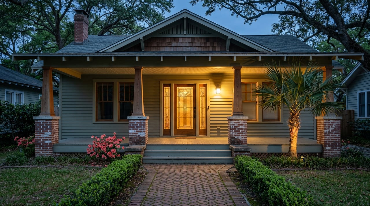
Two bungalows built the same decade, three blocks apart, both close enough to smell the bay. One buyer gets an insurance quote under a thousand dollars a year. The other gets a quote north of six thousand. Neither buyer did anything wrong. They just bought on different sides of a line that has nothing to do with curb appeal.
That line is the reason Old Southeast's listings span such an unusual range, from Craftsman bungalows starting around $500,000 to renovated mid-century homes pushing past $2 million, inside a neighborhood barely half a square mile wide. Most buyers assume that spread tracks square footage or how recently the kitchen was redone. It tracks something else: where each address sits relative to a flood zone boundary that runs through this neighborhood in ways that don't always follow your intuition about distance from the water.
What The Median Price Doesn't Explain
Multiple listing service data through mid-2026 shows Old Southeast's median sale price sitting somewhere in the mid-$600,000s over the trailing three months, up more than 10 percent from the same period a year earlier, with homes moving in roughly 18 days. That's a healthy market by any read. But a median is an average of two different stories happening at once, and in this neighborhood those stories diverge sharply once you leave the middle of the distribution.
At the low end of Old Southeast's range sit bungalows in the $500,000s, generally set back from the immediate waterfront, closer to the 4th Street South boundary that marks the neighborhood's western edge. At the top sit homes like the fully renovated four-bedroom bungalow on 22nd Avenue South that listed for $1.08 million in February 2026, a 1940-built home on a 0.23-acre corner lot steps from Lassing Park, with a new saltwater pool and an oversized front porch to go with it. Between those two poles, a wide middle band of homes trades in the $550,000 to $900,000 range, and that band is disproportionately made up of what agents in this market describe as the higher-ground blocks close to Lassing Park itself.
That last detail is the one worth sitting with, because it cuts against the assumption most buyers walk in with.
Ground That Rises Faster Than You'd Guess
The instinct is to treat "closer to the water" and "worse flood exposure" as the same thing. In Old Southeast, they aren't always the same thing, and the neighborhood's own geography is the reason.
Old Southeast runs from 4th Street South on its western edge to the Lassing Park bayfront on its east, a walk of less than 20 minutes down to downtown that crosses Salt Creek, passes Bayboro Harbor Marina, and cuts through the University of South Florida St. Petersburg campus, according to the Old Southeast Neighborhood Association. The park itself was a gift from Judge Robert B. Lassing, who donated the waterfront land to the city in 1924 with the stipulation that it stay parkland, and the city expanded it in 1926, 1944, and 1945 before formally dedicating it in January 1942. Ground that has been a public bayfront for a century tends to sit on whatever natural rise existed before development, and that rise doesn't stop at the property line. Blocks set back from the immediate shoreline but still within a few minutes' walk of the park can sit meaningfully higher than blocks farther inland toward 4th Street, which is part of why that middle price band clusters where it does.
That doesn't mean the water has been forgiving. Lassing Park has lost more than 20 feet of shoreline at its northern end to storm damage and sea level rise, prompting the city and Tampa Bay Watch to launch a joint erosion project at the park in late 2021. The park's edge and the blocks behind it are not the same risk profile, even though they're a five-minute walk apart. A dog walker at the park told a local reporter last year, "people don't know that this park exists," which says something about how quietly this stretch of the neighborhood sits relative to its actual exposure history.
The Same Neighborhood, Different Insurance Bills
FEMA's flood zone designations are the mechanism that turns "higher ground" into a dollar figure, and the range is wide enough to change what a buyer can actually afford at a given price point.
| FEMA Zone | Typical Situation | Approximate Annual Premium |
|---|---|---|
| Zone VE / coastal high-velocity | Direct bay frontage, wave action exposure | $8,000 and up |
| Zone AE, no elevation certificate | Standard high-risk designation | $3,000 to $8,000 |
| Zone AE, elevation certificate above base flood elevation | Same zone, documented higher floor | $1,200 to $3,500 |
| Zone X / X500, preferred | Higher ground, insurance optional | $600 to $1,100 |
Those bands come from current flood insurance market pricing across coastal Pinellas County, and they explain why two Old Southeast homes at similar price points can carry wildly different carrying costs. A buyer comparing a $700,000 listing on the higher ground near Lassing Park against a $650,000 listing closer to the creek isn't just comparing square footage. They may be comparing an X-zone optional policy against a mandatory AE policy that adds several thousand dollars a year to the real cost of ownership, a gap that doesn't show up anywhere on a listing sheet.
The Document That Can Swing The Number By Thousands
The single biggest lever inside that table is the elevation certificate, a surveyor-prepared document that measures a structure's floor height against the base flood elevation FEMA has assigned to that block. The city of St. Petersburg's floodplain office issues guidance and permitting for exactly this kind of construction question, and buyers who order a certificate before closing can sometimes cut an AE-zone premium by more than half if the slab sits above the required line. Without one, insurers price the policy as if the home sits at the worst-case elevation for its zone.
For a neighborhood built mostly between the 1920s and 1950s, according to the neighborhood association's own count of roughly 500 homes, this certificate is not a formality. Many of these houses predate the flood maps entirely, which means nobody has ever measured them against current standards unless a past owner or a recent buyer ordered the survey. Two identical bungalows on the same block can carry different premiums simply because one owner spent the $300 to $500 on a certificate and the other never did.
What A Renovation Can Trigger On Older Stock
Old Southeast's appeal to renovators is part of what's driving the top of its price range, but pre-1970s construction inside a mapped flood zone carries a rule that catches people off guard. If the cost of repairs or improvements to a home in a Special Flood Hazard Area exceeds a set percentage of the structure's market value, generally around 50 percent under the city's standard, the entire structure must be brought up to current flood code, which usually means physically elevating it. Pinellas County applies its own version of this threshold to unincorporated parcels, and the exact number can shift depending on which jurisdiction's rule governs a given address, so this is worth confirming with the city's floodplain office before a renovation budget is finalized, not after the contractor has already opened a wall.
The 22nd Avenue South bungalow that sold in the renovated $1 million-plus tier is a useful data point here. A full renovation on a 1940-built home near the park pushed it well past the neighborhood's middle band, which suggests the work stayed under that substantial improvement threshold or the home already sat above base flood elevation to begin with. A buyer eyeing a similar project on a lower block should run that math before assuming the same outcome is available at the same cost.
What This Means If You're Comparing Two Old Southeast Listings
Price per square foot is not a reliable filter here. Two questions do more work than any comp sheet:
First, what FEMA zone is the specific parcel in, and is there an elevation certificate on file. Pinellas County's flood map service and FEMA's own map service center will show the zone by address, but the certificate itself, if one exists, has to be requested separately.
Second, if the plan includes a major renovation, what does the substantial improvement math look like against this specific structure's current market value, not the neighborhood's median.
Neither question shows up in a listing description. Both change the real number a buyer is signing up for.
FAQ
Does living closer to Lassing Park mean higher flood insurance in Old Southeast? Not automatically. Ground near the park can sit higher than ground farther inland toward 4th Street South, and FEMA zone designations follow elevation, not straight-line distance to the bay. Each parcel needs its own zone check.
How much can an elevation certificate actually save? For a home in Zone AE, a certificate showing the floor above base flood elevation can move the annual premium from the $3,000 to $8,000 range down toward $1,200 to $3,500, depending on the specific elevation documented.
Can I renovate an older Old Southeast bungalow without triggering the substantial improvement rule? It depends on the renovation budget relative to the home's current market value and which jurisdiction's threshold applies. Confirming this with the city or county floodplain office before signing contracts is the only way to know for certain.
If you're weighing two Old Southeast addresses and the price difference doesn't match what you're seeing on paper, the flood zone and the elevation certificate are usually where the real answer is hiding. Melody Stang has spent years walking these blocks and knows which ones carry which exposure. Let's connect — schedule a consultation.